
Kuringen topographic map
Interactive map
Click on the map to display elevation.
About this map
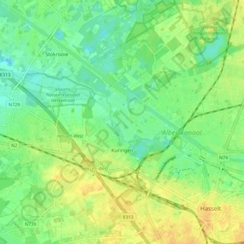
Name: Kuringen topographic map, elevation, terrain.
Location: Kuringen, Hasselt, Limburg, 3511, België (50.92211 5.25703 50.97882 5.34295)
Average elevation: 33 m
Minimum elevation: 20 m
Maximum elevation: 46 m
Other topographic maps
Click on a map to view its topography, its elevation and its terrain.
Rapertingen
België > Limburg > Hasselt > Hasselt
Rapertingen, Hasselt, Limburg, Vlaanderen, België
Average elevation: 49 m
Heksenberg
België > Limburg > Hasselt > Hasselt > Heksenberg
Heksenberg, Banneux, Hasselt, Limburg, Vlaanderen, 3500, België
Average elevation: 35 m