Geolocate

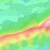
Sainte-Madeleine topographic map

Click on the map to display elevation.

About this map

Name: Sainte-Madeleine topographic map, elevation, terrain.

Location: Sainte-Madeleine, Plan-d'Aups-Sainte-Baume, Brignoles, Var, Provence-Alpes-Côte d'Azur, France métropolitaine, 83640, France (43.30419 5.69087 43.34419 5.73087)

Average elevation: 741 m

Minimum elevation: 499 m

Maximum elevation: 1,042 m

Other topographic maps

Click on a map to view its topography, its elevation and its terrain.
Gear up for your next adventure:

🛶Canoe Life Vest - Safety vest for water sports
🏕️Camping Hammock - Integrated protection for sleeping between trees
🥾Mountain Hiking Shoes - Shoes with superior grip for mountainous terrain
🥾Hiking Leggings - Comfortable leggings for outdoor activities
🧦Outdoor Socks - Durable socks designed for hiking and outdoor sports

As an Amazon Associate, this site earns from qualifying purchases at no extra cost to you.