Geolocate

Minden topographic map

Click on the map to display elevation.

About this map

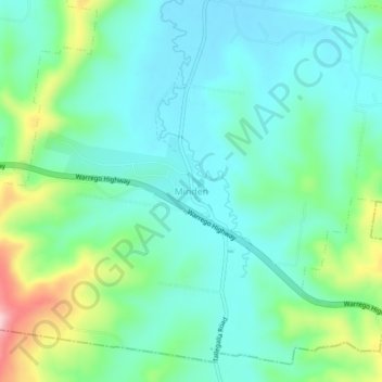
Name: Minden topographic map, elevation, terrain.

Location: Minden, Somerset Regional, Queensland, Australia (-27.57258 152.52245 -27.53258 152.56245)

Average elevation: 135 m

Minimum elevation: 78 m

Maximum elevation: 308 m

Other topographic maps

Click on a map to view its topography, its elevation and its terrain.

Minden

Australia > Queensland > Minden

Average elevation: 138 m

Gear up for your next adventure:

👟Sport Hiking Sandals - Breathable footwear for water crossings and camp rest
🧣Merino Neck Gaiter - Protects against wind, sun, and cold at high altitudes
Lightweight Camping Tent - Portable shelter optimized for Canadian backcountry camping
🛶Kayak Dry Bag - Waterproof storage for kayaking adventures
🛶Waterproof Dry Bags - Keep electronics and clothes dry during river crossings

As an Amazon Associate, this site earns from qualifying purchases at no extra cost to you.