
Inglis topographic map
Interactive map
Click on the map to display elevation.
About this map
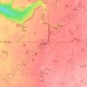
Name: Inglis topographic map, elevation, terrain.
Average elevation: 571 m
Minimum elevation: 493 m
Maximum elevation: 590 m
Other topographic maps
Click on a map to view its topography, its elevation and its terrain.
Angusville
Canada > Manitoba > Division No. 16 > Rural Municipality of Riding Mountain West > Angusville
Angusville, Rural Municipality of Riding Mountain West, Division No. 16, Manitoba, Canada
Average elevation: 579 m
Lake of the Prairies
Canada > Manitoba > Division No. 16 > Rural Municipality of Riding Mountain West
Lake of the Prairies, Rural Municipality of Riding Mountain West, Division No. 16, Manitoba, Canada
Average elevation: 502 m