Geolocate

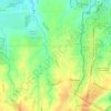
Sampaloc 3 topographic map

Click on the map to display elevation.

About this map

Name: Sampaloc 3 topographic map, elevation, terrain.

Location: Sampaloc 3, Sampaloc, Dasmariñas, Cavite, Calabarzon, Philippines (14.26062 120.97194 14.29459 120.98744)

Average elevation: 197 m

Minimum elevation: 146 m

Maximum elevation: 243 m

Other topographic maps

Click on a map to view its topography, its elevation and its terrain.
Mango Village

Philippines > Cavite > Dasmarinas

Average elevation: 63 m

Luksuhin Dam

Philippines > Cavite > Dasmarinas

Average elevation: 127 m

Pasong Tinta

Philippines > Cavite > Dasmarinas

Average elevation: 79 m

Piela

Philippines > Cavite > Dasmarinas > Piela

Average elevation: 170 m

Humayao

Philippines > Cavite > Dasmarinas

Average elevation: 202 m

Tibagan

Philippines > Cavite > Dasmarinas

Average elevation: 72 m

Malipay

Philippines > Cavite > Dasmarinas

Average elevation: 71 m

Gear up for your next adventure:

⛺Tent Footprint - Protect tent floor and increase durability
🥾Trail Hiking Shoes - Durable shoes designed for rugged trails
💧Hydration Pack - Hands-free hydration system for long hikes
🔥Camping Stove - Portable stoves to cook outdoors with ease
🦯Trekking Poles - Reduced impact on joints for steep topographic climbs

As an Amazon Associate, this site earns from qualifying purchases at no extra cost to you.