Geolocate

Uripa topographic map

Click on the map to display elevation.

About this map

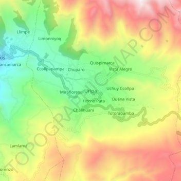
Name: Uripa topographic map, elevation, terrain.

Location: Uripa, Anco-Huallo, Province of Chincheros, Apurímac, Peru (-13.57278 -73.71790 -13.49278 -73.63790)

Average elevation: 3,582 m

Minimum elevation: 2,810 m

Maximum elevation: 4,577 m

Gear up for your next adventure:

Backpacking Tent - Lightweight tent for long-distance hiking trips
💧Hydration Pack - Hands-free hydration system for long hikes
💧Reusable Water Bottle - Durable water bottles for hydration on trails
Tent Footprint - Protect tent floor and increase durability
🌬️Windproof Camp Stove - Efficient cooking even on exposed mountain peaks

As an Amazon Associate, this site earns from qualifying purchases at no extra cost to you.