Geolocate

McCordsville topographic map

Click on the map to display elevation.

About this map

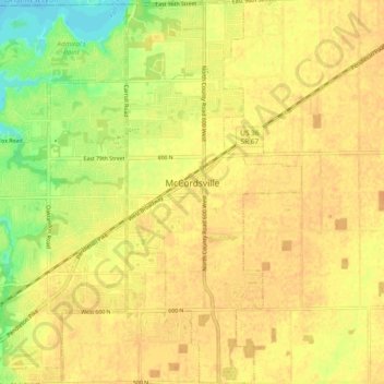
Name: McCordsville topographic map, elevation, terrain.

Location: McCordsville, Hancock County, Indiana, 46055, United States (39.85613 -85.93844 39.92821 -85.89520)

Average elevation: 259 m

Minimum elevation: 237 m

Maximum elevation: 268 m

Other topographic maps

Click on a map to view its topography, its elevation and its terrain.

Cleveland

United States > Indiana > Hancock County

Average elevation: 292 m

Gear up for your next adventure:

🌡️Emergency Mylar Blankets - Compact thermal protection for unexpected nights outdoors
🛶Kayak Accessories - Essential gear for safe and fun kayaking adventures
🩹Moleskin Blister Pads - Direct protection for painful foot pressure points
🧳Compression Sacks - Maximize space in your backpack by shrinking gear
🛌Down Sleeping Bag - Superior warmth-to-weight ratio for cold nights

As an Amazon Associate, this site earns from qualifying purchases at no extra cost to you.