Geolocate

Ousse topographic map

Click on the map to display elevation.

About this map
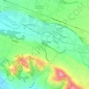
Name: Ousse topographic map, elevation, terrain.

Location: Ousse, Pau, Pyrénées-Atlantiques, Nouvelle-Aquitaine, Metropolitan France, 64320, France (43.25793 -0.28093 43.29502 -0.25383)

Average elevation: 257 m

Minimum elevation: 209 m

Maximum elevation: 348 m

Other topographic maps

Click on a map to view its topography, its elevation and its terrain.

Accous

France > Nouvelle-Aquitaine > Pyrénées-Atlantiques

Average elevation: 1,771 m

Gear up for your next adventure:

❄️Traction Ice Cleats - Slip-on spikes for icy trails and winter hiking
🥘Camping Cookware Set - Compact nesting pots and pans for trail cooking
🔥Emergency Fire Starter - Reliable ignition source for all weather conditions
🛌Insulated Sleeping Pad - Critical thermal barrier between you and the cold ground
⛺Camping Groundsheet - Protect your tent from moisture and dirt

As an Amazon Associate, this site earns from qualifying purchases at no extra cost to you.