Geolocate

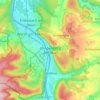
Röllfeld topographic map

Click on the map to display elevation.

About this map

Name: Röllfeld topographic map, elevation, terrain.

Location: Röllfeld, Klingenberg am Main, Landkreis Miltenberg, Bayern, 63911, Deutschland (49.73944 9.17651 49.77663 9.22714)

Average elevation: 203 m

Minimum elevation: 115 m

Maximum elevation: 341 m

Other topographic maps

Click on a map to view its topography, its elevation and its terrain.
Gear up for your next adventure:

🧭GPS Tracker - Track your location in remote areas safely
🥫Freeze-Dried Meals - Lightweight, high-calorie nutrition for multi-day treks
🧴Outdoor Sunscreen - High SPF protection for high-altitude UV exposure
🥾Trail Hiking Socks - Comfortable socks to prevent blisters and fatigue
🥘Camping Cookware Set - Compact nesting pots and pans for trail cooking

As an Amazon Associate, this site earns from qualifying purchases at no extra cost to you.