Geolocate

Monterano topographic map

Click on the map to display elevation.

About this map
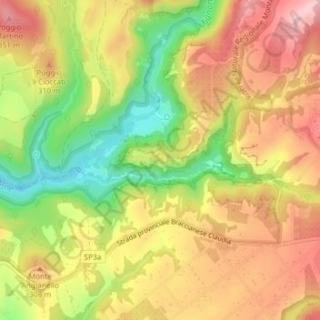
Name: Monterano topographic map, elevation, terrain.

Location: Monterano, Canale Monterano, Roma, Lazio, Italia (42.12343 12.06829 42.14343 12.08829)

Average elevation: 272 m

Minimum elevation: 162 m

Maximum elevation: 360 m

Other topographic maps

Click on a map to view its topography, its elevation and its terrain.

Gear up for your next adventure:

🏕️Camping Hammock - Integrated protection for sleeping between trees
🛶Canoe Life Vest - Safety vest for water sports
👟Trail Running Shoes - Agile footwear for fast-paced topographic exploration
🧰Multitool Knife - Compact and versatile tool for outdoor use
🧢Beanie Hat - Keep your head warm in cold weather

As an Amazon Associate, this site earns from qualifying purchases at no extra cost to you.