Geolocate

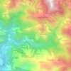
Lekbeshi topographic map

Click on the map to display elevation.

About this map

Name: Lekbeshi topographic map, elevation, terrain.

Location: Lekbeshi, Surkhet, Karnali Province, Nepal (28.45088 81.66707 28.62087 81.85026)

Average elevation: 966 m

Minimum elevation: 420 m

Maximum elevation: 2,304 m

Other topographic maps

Click on a map to view its topography, its elevation and its terrain.

Bheri River

Nepal > Karnali Province > Surkhet > Botechaur

Average elevation: 1,112 m

Chautara

Nepal > Karnali Province > Surkhet > Birendranagar

Average elevation: 1,197 m

Gaighat

Nepal > Karnali Province > Surkhet

Average elevation: 545 m

Manikapur

Nepal > Karnali Province > Surkhet

Average elevation: 673 m

Dapcha

Nepal > Karnali Province > Surkhet

Average elevation: 1,088 m

Mulpani

Nepal > Karnali Province > Surkhet

Average elevation: 654 m

Ghari Mehelkuna

Nepal > Karnali Province > Surkhet

Average elevation: 563 m

Gear up for your next adventure:

🔋Emergency Crank Radio - Weather alerts and power without needing batteries
🧥Waterproof Pants - Keep dry during rainy hiking conditions
🥾Trail Running Shoes - Lightweight and durable shoes for trail running
⛺Lightweight Camping Tent - Portable shelter optimized for Canadian backcountry camping
🧭GPS Handheld Device - Reliable GPS navigation for outdoor adventures

As an Amazon Associate, this site earns from qualifying purchases at no extra cost to you.