Geolocate

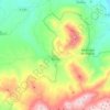
Portillos topographic map

Click on the map to display elevation.

About this map

Name: Portillos topographic map, elevation, terrain.

Location: Portillos, Torres, Jaén, Andalucía, 23540, España (37.75351 -3.53661 37.77351 -3.51661)

Average elevation: 1,222 m

Minimum elevation: 968 m

Maximum elevation: 1,534 m

Other topographic maps

Click on a map to view its topography, its elevation and its terrain.
Torres

España > Andalucía > Torres

Average elevation: 1,046 m

Gear up for your next adventure:

🧊Portable Cooler - Keep food and drinks cold during outdoor adventures
⛺Backpacking Tent - Lightweight tent for long-distance hiking trips
🧼Travel Hand Sanitizer - Keep hands clean when water is scarce
💧Filtered Water Bottle - Safe drinking water on the go
🔨Vehicle Emergency Tool - Safety tool for remote road trips to trailheads

As an Amazon Associate, this site earns from qualifying purchases at no extra cost to you.