Geolocate

Culaba topographic map

Click on the map to display elevation.

About this map
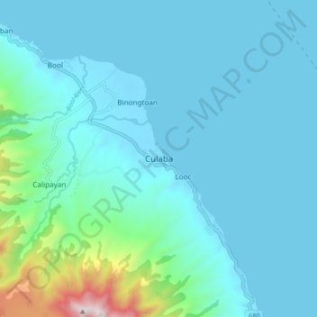
Name: Culaba topographic map, elevation, terrain.

Location: Culaba, Biliran, Eastern Visayas, 6547, Philippines (11.61560 124.50062 11.69560 124.58062)

Average elevation: 124 m

Minimum elevation: -1 m

Maximum elevation: 1,021 m

Other topographic maps

Click on a map to view its topography, its elevation and its terrain.

Biliran

Philippines > Biliran

Average elevation: 170 m

Maripipi

Philippines > Biliran

Average elevation: 52 m

Anas River

Philippines > Biliran > Larrazabal

Average elevation: 200 m

Sambawan Islands

Philippines > Biliran > Maripipi

Average elevation: 0 m

Biliran

Philippines > Biliran

Average elevation: 170 m

Gear up for your next adventure:

⛺Bushcraft Tarp - Versatile emergency shelter or gear protection
☕Camping Coffee Maker - Brew fresh coffee anywhere on the topographic map
🚲Heavy Duty Bike Lock - Secure your bike at the trailhead or during stops
🔪Outdoor Multitool - Versatile tool for repairs and food prep in the wild
🧦Hiking Socks - Moisture-wicking and comfortable socks for long hikes

As an Amazon Associate, this site earns from qualifying purchases at no extra cost to you.