Geolocate

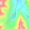
Machulo topographic map

Click on the map to display elevation.

About this map

Name: Machulo topographic map, elevation, terrain.

Location: Machulo, Khaplu Tehsil, Ghanche District, Baltistan Division, Gilgit-Baltistan, Pakistan (35.20210 76.35834 35.28210 76.43834)

Average elevation: 3,071 m

Minimum elevation: 2,498 m

Maximum elevation: 4,718 m

Other topographic maps

Click on a map to view its topography, its elevation and its terrain.
Barah Broq

Pakistan > Gilgit-Baltistan > Ghanche District

Average elevation: 4,718 m

Gear up for your next adventure:

🥾All-Terrain Hiking Boots - Versatile boots for varied hiking conditions
🥾Waterproof Hiking Boots - Essential footwear for rugged terrain and wet Canadian trails
🥾Trail Running Boots - Durable shoes designed for trail running
💧Collapsible Water Bottle - Space-saving water bottle for outdoor activities
🧳Compression Sacks - Maximize space in your backpack by shrinking gear

As an Amazon Associate, this site earns from qualifying purchases at no extra cost to you.