Geolocate

Buke topographic map

Click on the map to display elevation.

About this map
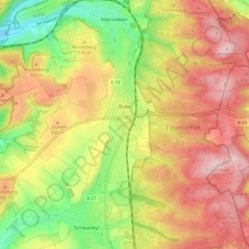
Name: Buke topographic map, elevation, terrain.

Location: Buke, Altenbeken, Kreis Paderborn, North Rhine-Westphalia, 33184, Germany (51.71622 8.89803 51.75851 8.99085)

Average elevation: 332 m

Minimum elevation: 207 m

Maximum elevation: 438 m

Other topographic maps

Click on a map to view its topography, its elevation and its terrain.

Gear up for your next adventure:

🧥Thermal Layer - Insulating layer for cold outdoor conditions
🥾Hiking Boots - Sturdy boots providing ankle support and traction on rugged trails
💡Portable Camping Lamp - Rechargeable lamp for campsite lighting
🔦LED Headtorch - Bright and durable light for night activities
🛶Kayak Accessories - Essential gear for safe and fun kayaking adventures

As an Amazon Associate, this site earns from qualifying purchases at no extra cost to you.