Geolocate

Buke topographic map

Click on the map to display elevation.

About this map
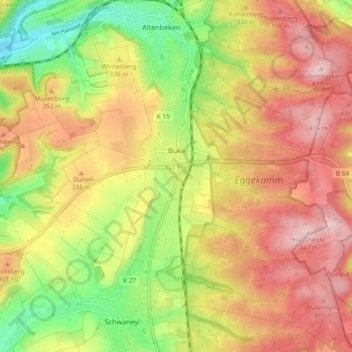
Name: Buke topographic map, elevation, terrain.

Location: Buke, Altenbeken, Kreis Paderborn, North Rhine-Westphalia, 33184, Germany (51.71622 8.89803 51.75851 8.99085)

Average elevation: 332 m

Minimum elevation: 207 m

Maximum elevation: 438 m

Other topographic maps

Click on a map to view its topography, its elevation and its terrain.

Gear up for your next adventure:

🧴Bear Spray Holster - Quick-access carry for essential Canadian wilderness safety
💧Reusable Water Bottle - Durable water bottles for hydration on trails
🔪Outdoor Multitool - Versatile tool for repairs and food prep in the wild
🥾Trail Running Boots - Durable shoes designed for trail running
💧Collapsible Water Bottle - Space-saving water bottle for outdoor activities

As an Amazon Associate, this site earns from qualifying purchases at no extra cost to you.