Geolocate

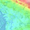
Talhouët topographic map

Click on the map to display elevation.

About this map

Name: Talhouët topographic map, elevation, terrain.

Location: Talhouët, Theix, Theix-Noyalo, Vannes, Morbihan, Bretagne, France métropolitaine, 56450, France (47.64007 -2.70043 47.68007 -2.66043)

Average elevation: 28 m

Minimum elevation: 0 m

Maximum elevation: 99 m

Other topographic maps

Click on a map to view its topography, its elevation and its terrain.
Theix

France > Bretagne > Morbihan > Theix-Noyalo

Average elevation: 29 m

Theix

France > Bretagne > Morbihan > Theix-Noyalo

Average elevation: 29 m

Gear up for your next adventure:

🔥Emergency Fire Starter - Reliable ignition source for all weather conditions
🦶Anti-Blister Balm - Prevents friction and hotspots during long ascents
🏕️Camping Hammock - Integrated protection for sleeping between trees
🥾Waterproof Hiking Shoes - Durable shoes for wet and rugged trails
💧Filtered Water Bottle - Safe drinking water on the go

As an Amazon Associate, this site earns from qualifying purchases at no extra cost to you.