Geolocate

Reinach topographic map

Click on the map to display elevation.

About this map
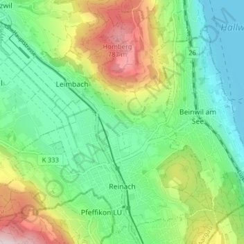
Name: Reinach topographic map, elevation, terrain.

Location: Reinach, Bezirk Kulm, Aargau, 5734, Switzerland (47.24551 8.14254 47.28538 8.20672)

Average elevation: 575 m

Minimum elevation: 445 m

Maximum elevation: 833 m

Gear up for your next adventure:

🩹Moleskin Blister Pads - Direct protection for painful foot pressure points
🎒Backpack Rain Cover - External shield to keep your entire pack dry
🧤Thermal Hiking Gloves - Grip-enhanced gloves for cold-weather altitude trekking
🏃Hydration Running Vest - Carry water and maps close to your body for speed
💡Compact LED Flashlight - Powerful and portable flashlight for outdoor use

As an Amazon Associate, this site earns from qualifying purchases at no extra cost to you.