Geolocate

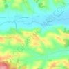
Franquevielle topographic map

Click on the map to display elevation.

About this map

Name: Franquevielle topographic map, elevation, terrain.

Location: Franquevielle, Saint-Gaudens, Haute-Garonne, Occitania, Metropolitan France, 31210, France (43.11797 0.49296 43.14891 0.56788)

Average elevation: 511 m

Minimum elevation: 394 m

Maximum elevation: 565 m

Other topographic maps

Click on a map to view its topography, its elevation and its terrain.
Crouzet

France > Occitania > Haute-Garonne > Saint-Gaudens

Average elevation: 374 m

Luquets

France > Occitania > Haute-Garonne > Buzet-sur-Tarn

Average elevation: 133 m

La Lune

France > Occitania > Haute-Garonne > Terrebasse

Average elevation: 321 m

Montagnac

France > Occitania > Haute-Garonne > Saint-Frajou

Average elevation: 294 m

Petit Jean

France > Occitania > Haute-Garonne > Lapeyrère

Average elevation: 324 m

Gear up for your next adventure:

🦟Insect Repellent - Keep mosquitoes and black flies away in wooded areas
🧥Ultralight Puffy Jacket - Maximum warmth that packs down to the size of an orange
🧶550 Survival Paracord - Versatile utility cord for emergency repairs and rigging
💧Collapsible Water Bottle - Space-saving water bottle for outdoor activities
🧦Crew Hiking Socks - Comfortable socks for long-distance hikes

As an Amazon Associate, this site earns from qualifying purchases at no extra cost to you.