Geolocate

Pala topographic map

Click on the map to display elevation.

About this map

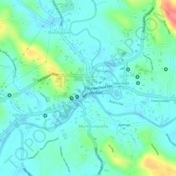
Name: Pala topographic map, elevation, terrain.

Location: Pala, Meenachil, Kottayam, Kerala, 686575, India (9.70481 76.67113 9.72133 76.69413)

Average elevation: 28 m

Minimum elevation: 8 m

Maximum elevation: 89 m

Gear up for your next adventure:

🧥Thermal Layer - Insulating layer for cold outdoor conditions
💧Reusable Water Bottle - Durable water bottles for hydration on trails
🥾Hiking Boots - Sturdy boots providing ankle support and traction on rugged trails
🧊Insulated Water Bottle - Keeps drinks cold in summer and prevents freezing in winter
🥾Lightweight Hiking Boots - Boots for comfort and mobility on long hikes

As an Amazon Associate, this site earns from qualifying purchases at no extra cost to you.