
Porciles topographic map
Interactive map
Click on the map to display elevation.
About this map
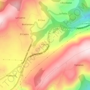
Name: Porciles topographic map, elevation, terrain.
Location: Porciles, Asturias, España (43.40805 -6.31070 43.41011 -6.30820)
Average elevation: 654 m
Minimum elevation: 407 m
Maximum elevation: 808 m
Other topographic maps
Click on a map to view its topography, its elevation and its terrain.