Geolocate

Toril topographic map

Click on the map to display elevation.

About this map

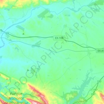
Name: Toril topographic map, elevation, terrain.

Location: Toril, Cáceres, Extremadura, 10591, Spain (39.81707 -6.02285 39.96208 -5.74823)

Average elevation: 273 m

Minimum elevation: 220 m

Maximum elevation: 577 m

Other topographic maps

Click on a map to view its topography, its elevation and its terrain.

Padre Jacinto

Spain > Extremadura > Segura de León

Average elevation: 488 m

Gear up for your next adventure:

🦟Insect Repellent - Keep mosquitoes and black flies away in wooded areas
🎒Hiking Backpack - Lightweight and ergonomic backpacks for day hikes or multi-day treks
🛌Insulated Sleeping Pad - Critical thermal barrier between you and the cold ground
🧊Portable Cooler - Keep food and drinks cold during outdoor adventures
🥾Approach Shoes - Shoes designed for climbing approaches and rugged trails

As an Amazon Associate, this site earns from qualifying purchases at no extra cost to you.