Geolocate

Les Fez topographic map

Click on the map to display elevation.

About this map
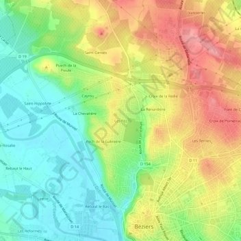
Name: Les Fez topographic map, elevation, terrain.

Location: Les Fez, Béziers, Hérault, Occitanie, France métropolitaine, 34500, France (43.34018 3.18784 43.38018 3.22784)

Average elevation: 57 m

Minimum elevation: 9 m

Maximum elevation: 115 m

Other topographic maps

Click on a map to view its topography, its elevation and its terrain.

34500

France > Occitanie > Hérault > Béziers

Average elevation: 43 m

Gear up for your next adventure:

🧥Insulated Jacket - Keep warm in cold outdoor conditions
🥾Mountain Hiking Shoes - Shoes with superior grip for mountainous terrain
💡Portable Camping Lamp - Rechargeable lamp for campsite lighting
🧢Outdoor Visor - Breathable visor for sunny hikes
🧢Sun Protection Cap - Breathable cap to protect from sun exposure

As an Amazon Associate, this site earns from qualifying purchases at no extra cost to you.