Geolocate

La Roche topographic map

Click on the map to display elevation.

About this map

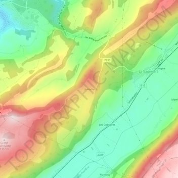
Name: La Roche topographic map, elevation, terrain.

Location: La Roche, La Sagne, Neuchâtel, 2314, Switzerland (47.01452 6.75884 47.05452 6.79884)

Average elevation: 1,115 m

Minimum elevation: 945 m

Maximum elevation: 1,330 m

Gear up for your next adventure:

🗺️Topographic Maps - Detailed maps to explore trails, mountains, and wilderness areas
🔥Emergency Fire Starter - Reliable ignition source for all weather conditions
🥾Mountain Trail Shoes - High-traction shoes for mountain trails
🩹Moleskin Blister Pads - Direct protection for painful foot pressure points
📷Outdoor Action Camera - Capture high-elevation views and rugged adventures

As an Amazon Associate, this site earns from qualifying purchases at no extra cost to you.