Geolocate

Balurghat topographic map

Click on the map to display elevation.

About this map

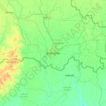
Name: Balurghat topographic map, elevation, terrain.

Location: Balurghat, Dakshin Dinajpur, West Bengal, 733101, India (25.06344 88.61807 25.38344 88.93807)

Average elevation: 26 m

Minimum elevation: 15 m

Maximum elevation: 49 m

Gear up for your next adventure:

🥾Lightweight Hiking Shoes - Comfortable shoes for day hikes
🧊Insulated Water Bottle - Keeps drinks cold in summer and prevents freezing in winter
🛰️Satellite Messenger - Emergency communication for areas with no cell service
🥾Hiking Shorts - Breathable shorts suitable for summer hikes
🏃Hydration Running Vest - Carry water and maps close to your body for speed

As an Amazon Associate, this site earns from qualifying purchases at no extra cost to you.