Geolocate

Schachen topographic map

Click on the map to display elevation.

About this map

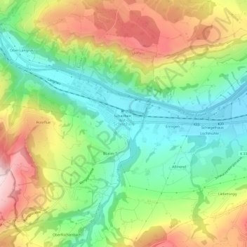
Name: Schachen topographic map, elevation, terrain.

Location: Schachen, Werthenstein, Lucerne, 6105, Switzerland (47.01588 8.12356 47.05588 8.16356)

Average elevation: 671 m

Minimum elevation: 496 m

Maximum elevation: 926 m

Gear up for your next adventure:

🧴Waterproofing Spray - Restore the DWR coating on jackets and tents
🔨Vehicle Emergency Tool - Safety tool for remote road trips to trailheads
🧣Evaporative Cooling Towel - Beat the heat during intense summer climbs
💡Compact LED Flashlight - Powerful and portable flashlight for outdoor use
🚲Heavy Duty Bike Lock - Secure your bike at the trailhead or during stops

As an Amazon Associate, this site earns from qualifying purchases at no extra cost to you.