
Thank you for supporting this site ❤️
Make a donation
Make a donation
Gear up for your next adventure:
As an Amazon Associate, this site earns from qualifying purchases at no extra cost to you.
Huimin District topographic map
Click on the map to display elevation.
Thank you for supporting this site ❤️
Make a donation
Make a donation
Gear up for your next adventure:
As an Amazon Associate, this site earns from qualifying purchases at no extra cost to you.
About this map
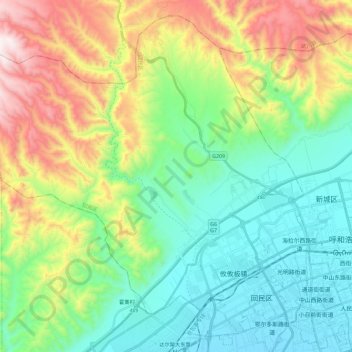
Name: Huimin District topographic map, elevation, terrain.
Location: Huimin District, Hohhot City, Inner Mongolia, China (40.78873 111.43886 40.94698 111.66848)
Average elevation: 1,363 m
Minimum elevation: 1,037 m
Maximum elevation: 2,076 m
Thank you for supporting this site ❤️
Make a donation
Make a donation
Gear up for your next adventure:
As an Amazon Associate, this site earns from qualifying purchases at no extra cost to you.