
Thank you for supporting this site ❤️
Make a donation
Make a donation
Gear up for your next adventure:
As an Amazon Associate, this site earns from qualifying purchases at no extra cost to you.
Nicelli topographic map
Click on the map to display elevation.
Thank you for supporting this site ❤️
Make a donation
Make a donation
Gear up for your next adventure:
As an Amazon Associate, this site earns from qualifying purchases at no extra cost to you.
About this map
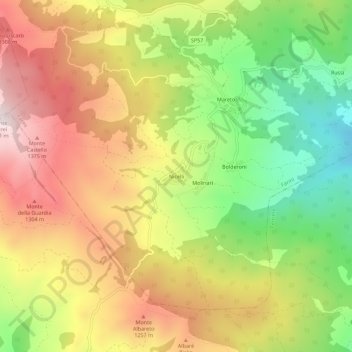
Name: Nicelli topographic map, elevation, terrain.
Location: Nicelli, Farini, Piacenza, Emilia-Romagna, 29024, Italia (44.67338 9.47688 44.71338 9.51688)
Average elevation: 1,071 m
Minimum elevation: 715 m
Maximum elevation: 1,420 m
Thank you for supporting this site ❤️
Make a donation
Make a donation
Gear up for your next adventure:
As an Amazon Associate, this site earns from qualifying purchases at no extra cost to you.