
Thank you for supporting this site ❤️
Make a donation
Make a donation
Gear up for your next adventure:
As an Amazon Associate, this site earns from qualifying purchases at no extra cost to you.
Egede topographic map
Click on the map to display elevation.
Thank you for supporting this site ❤️
Make a donation
Make a donation
Gear up for your next adventure:
As an Amazon Associate, this site earns from qualifying purchases at no extra cost to you.
About this map
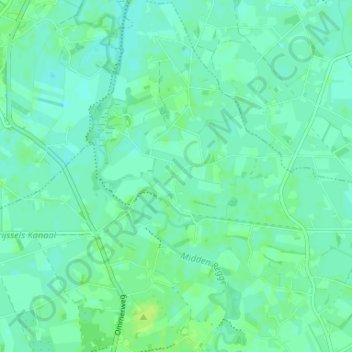
Name: Egede topographic map, elevation, terrain.
Location: Egede, Hellendoorn, Overijssel, Nederland, 7447, Nederland (52.42039 6.43431 52.46039 6.47431)
Average elevation: 8 m
Minimum elevation: 3 m
Maximum elevation: 15 m
Thank you for supporting this site ❤️
Make a donation
Make a donation
Gear up for your next adventure:
As an Amazon Associate, this site earns from qualifying purchases at no extra cost to you.