
Thank you for supporting this site ❤️
Make a donation
Make a donation
Gear up for your next adventure:
As an Amazon Associate, this site earns from qualifying purchases at no extra cost to you.
Losa topographic map
Click on the map to display elevation.
Thank you for supporting this site ❤️
Make a donation
Make a donation
Gear up for your next adventure:
As an Amazon Associate, this site earns from qualifying purchases at no extra cost to you.
About this map
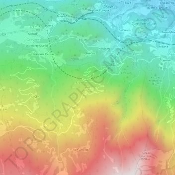
Name: Losa topographic map, elevation, terrain.
Location: Losa, Gravere, Torino, Piemont, 10059, Italy (45.09440 7.01516 45.13440 7.05516)
Average elevation: 1,112 m
Minimum elevation: 482 m
Maximum elevation: 2,048 m
Thank you for supporting this site ❤️
Make a donation
Make a donation
Gear up for your next adventure:
As an Amazon Associate, this site earns from qualifying purchases at no extra cost to you.