Geolocate

Delafield topographic map

Click on the map to display elevation.

About this map

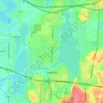
Name: Delafield topographic map, elevation, terrain.

Location: Delafield, Waukesha County, Wisconsin, 53018, United States (43.03960 -88.43006 43.10615 -88.34959)

Average elevation: 283 m

Minimum elevation: 260 m

Maximum elevation: 336 m

Gear up for your next adventure:

🥾Mountain Hiking Boots - High-traction boots for rocky terrain
🐕Hiking Dog Pack - Let your canine companion carry their own water and food
🧦Thermal Socks - Warm socks for winter hiking or camping
🦌Outdoor Trail Camera - Monitor wildlife activity near your favorite spots
👟Leg Gaiters - Keep debris, mud, and snow out of your boots

As an Amazon Associate, this site earns from qualifying purchases at no extra cost to you.