
Beira topographic map
Interactive map
Click on the map to display elevation.
About this map
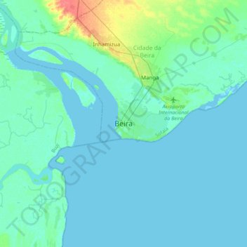
Name: Beira topographic map, elevation, terrain.
Location: Beira, Cidade da Beira, Provinz Sofala, 2100, Mosambik (-19.98871 34.68178 -19.66871 35.00178)
Average elevation: 5 m
Minimum elevation: -1 m
Maximum elevation: 42 m
Das RSMC La Réunion auf der Insel La Réunion überwacht die Wetterlage im südwestlichen Indik, besonders im Kanal von Mosambik. Dessen Wetterwarnung in Bezug auf den Zyklon Idai besagte für den 14. März 2019 in Beira einen Meeresspiegelanstieg von bis zu 4 Metern und eine Sturmflut mit Wellen von 5 bis 6 Metern Höhe in der Meeresmündung des Pungwe.
Other topographic maps
Click on a map to view its topography, its elevation and its terrain.