Geolocate

Flevoland topographic map

Click on the map to display elevation.

About this map
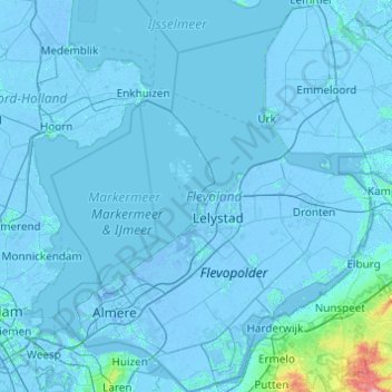
Name: Flevoland topographic map, elevation, terrain.

Location: Flevoland, Netherlands (52.24953 5.06043 52.84398 6.01730)

Average elevation: 1 m

Minimum elevation: -9 m

Maximum elevation: 96 m

Other topographic maps

Click on a map to view its topography, its elevation and its terrain.
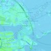
Amsterdam

Netherlands > North Holland > Amsterdam

Average elevation: -1 m

Oosterwijzend

Netherlands > North Holland > Hoogkarspel

Average elevation: -2 m

Oud-Zevenaar

Netherlands > Gelderland > Zevenaar

Average elevation: 12 m

Wittewierum

Netherlands > Groningen > Ten Post

Average elevation: -1 m

Meuse

Netherlands > Limburg > Baarlo

Average elevation: 22 m

Hout

Netherlands > North Brabant > Geldrop

Average elevation: 22 m

Zuidbarge

Netherlands > Drenthe > Emmen

Average elevation: 20 m

Groningen

Netherlands > Groningen > Groningen

Average elevation: 2 m

Gear up for your next adventure:

🎒Hiking Backpack - Lightweight and ergonomic backpacks for day hikes or multi-day treks
🪜Heavy Duty Carabiners - Multi-use clips for securing gear to your backpack
🧳Compression Sacks - Maximize space in your backpack by shrinking gear
👟Trail Running Shoes - Agile footwear for fast-paced topographic exploration
🧥Waterproof Jacket - Lightweight rain jackets for hiking and outdoor activities

As an Amazon Associate, this site earns from qualifying purchases at no extra cost to you.