Geolocate

Crailsheim topographic map

Click on the map to display elevation.

About this map
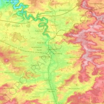
Name: Crailsheim topographic map, elevation, terrain.

Location: Crailsheim, VVG der Stadt Crailsheim, Landkreis Schwäbisch Hall, Baden-Württemberg, 74564, Germany (49.07913 9.94410 49.18628 10.16785)

Average elevation: 451 m

Minimum elevation: 339 m

Maximum elevation: 547 m

Other topographic maps

Click on a map to view its topography, its elevation and its terrain.

Gear up for your next adventure:

🔭Compact Monocular - One-handed bird watching and trail spotting
💡LED Camping Lantern - Illuminate your campsite with long-lasting lanterns
🔋Solar Power Bank - Keep your GPS and devices charged during long outdoor trips
🕶️Polarized Sunglasses - Reduces glare from snow and water at high elevations
⛺Family Camping Tent - Spacious tent suitable for family camping trips

As an Amazon Associate, this site earns from qualifying purchases at no extra cost to you.