Geolocate

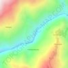
Sunkhani topographic map

Click on the map to display elevation.

About this map

Name: Sunkhani topographic map, elevation, terrain.

Location: Sunkhani, Panchakhapan, Sankhuwasabha, Koshi Province, Nepal (27.31446 87.33324 27.35446 87.37324)

Average elevation: 1,265 m

Minimum elevation: 729 m

Maximum elevation: 1,848 m

Other topographic maps

Click on a map to view its topography, its elevation and its terrain.

Silichong

Nepal > Koshi Province > Sankhuwasabha

Average elevation: 3,026 m

Arun River

Nepal > Koshi Province > Sankhuwasabha > Num

The Tibetan name Bum-chu may refer to a religious ceremony attempting to divine prospects for the coming year from the level of water in a pot or well, chu is the Tibetan word for water. The river originates near Gutso in Nyalam County of Tibet. Around 17 kilometres (11 mi) downstream, the Men-chu joins it.…

Average elevation: 1,153 m

Makalu

Nepal > Koshi Province > Sankhuwasabha

Average elevation: 3,737 m

Barun River

Nepal > Koshi Province > Sankhuwasabha

Average elevation: 4,950 m

Khandbari

Nepal > Koshi Province > Sankhuwasabha

Average elevation: 857 m

Khandbari

Nepal > Koshi Province > Sankhuwasabha

Average elevation: 857 m

Madi

Nepal > Koshi Province > Sankhuwasabha

Average elevation: 1,883 m

landslide

Nepal > Koshi Province > Sankhuwasabha

Average elevation: 3,808 m

Gear up for your next adventure:

🔦LED Flashlight - Powerful and long-lasting flashlight for camping and emergencies
🥾Trail Hiking Shoes - Durable shoes designed for rugged trails
🥾Hiking Shorts - Breathable shorts suitable for summer hikes
🧣Evaporative Cooling Towel - Beat the heat during intense summer climbs
🧢Sun Hat - Wide-brim hat for sun protection

As an Amazon Associate, this site earns from qualifying purchases at no extra cost to you.