
Port Glaud topographic map
Interactive map
Click on the map to display elevation.
About this map
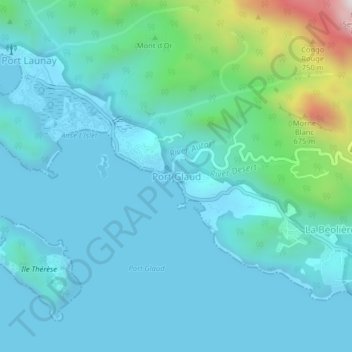
Name: Port Glaud topographic map, elevation, terrain.
Location: Port Glaud, Mahé, Seychelles (-4.68406 55.39776 -4.64406 55.43776)
Average elevation: 131 m
Minimum elevation: -2 m
Maximum elevation: 867 m
Other topographic maps
Click on a map to view its topography, its elevation and its terrain.