Geolocate

Abianbase topographic map

Click on the map to display elevation.

About this map

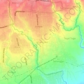
Name: Abianbase topographic map, elevation, terrain.

Location: Abianbase, Bali, 80582, Indonesia (-8.57568 115.30766 -8.53568 115.34766)

Average elevation: 97 m

Minimum elevation: 34 m

Maximum elevation: 149 m

Gear up for your next adventure:

🎒Hiking Backpack - Lightweight and ergonomic backpacks for day hikes or multi-day treks
🔦LED Headlamp - Hands-free lighting for early morning starts or late finishes
🗺️Topographic Maps - Detailed maps to explore trails, mountains, and wilderness areas
🩹Compact First Aid Kit - Pre-packed essentials for common trail injuries
🧥Waterproof Hiking Jacket - Protect yourself from rain and wind while hiking

As an Amazon Associate, this site earns from qualifying purchases at no extra cost to you.