Geolocate

Guamal topographic map

Click on the map to display elevation.

About this map

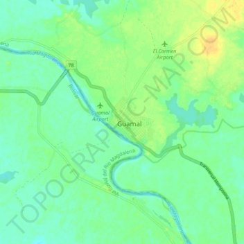
Name: Guamal topographic map, elevation, terrain.

Location: Guamal, Magdalena, Colombia (9.10453 -74.26613 9.18453 -74.18613)

Average elevation: 24 m

Minimum elevation: 15 m

Maximum elevation: 38 m

Gear up for your next adventure:

🧰Survival Kit - Essential gear for emergencies in the wilderness
🎒Fully Waterproof Backpack - Total protection for photography gear and electronics
🥾Trail Running Shoes - Lightweight and durable shoes for trail running
🛏️Sleeping Bag - Warm and compact sleeping bags for outdoor camping
Camping Essentials - All-in-one gear for a comfortable camping trip

As an Amazon Associate, this site earns from qualifying purchases at no extra cost to you.