
Thank you for supporting this site ❤️
Make a donation
Make a donation
Gear up for your next adventure:
As an Amazon Associate, this site earns from qualifying purchases at no extra cost to you.
Fuenteheridos topographic map
Click on the map to display elevation.
Thank you for supporting this site ❤️
Make a donation
Make a donation
Gear up for your next adventure:
As an Amazon Associate, this site earns from qualifying purchases at no extra cost to you.
About this map
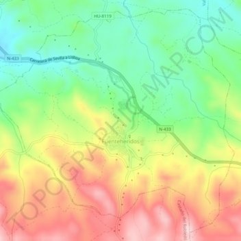
Name: Fuenteheridos topographic map, elevation, terrain.
Location: Fuenteheridos, Sierra de Aracena, Huelva, Andalusien, Spanien (37.88900 -6.68720 37.92446 -6.63881)
Average elevation: 712 m
Minimum elevation: 596 m
Maximum elevation: 853 m
Thank you for supporting this site ❤️
Make a donation
Make a donation
Gear up for your next adventure:
As an Amazon Associate, this site earns from qualifying purchases at no extra cost to you.