Geolocate

Cajibio topographic map

Click on the map to display elevation.

About this map

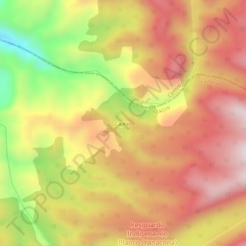
Name: Cajibio topographic map, elevation, terrain.

Location: Cajibio, La Vega, Macizo, Cauca, Colombia (2.00828 -76.63663 2.04828 -76.59663)

Average elevation: 3,218 m

Minimum elevation: 2,827 m

Maximum elevation: 3,490 m

Gear up for your next adventure:

🧣Evaporative Cooling Towel - Beat the heat during intense summer climbs
Camping Groundsheet - Protect your tent from moisture and dirt
🚲MTB Frame Bag - Carry tools and maps directly on your bicycle frame
🔭Outdoor Binoculars - Lightweight binoculars for birdwatching and hiking
🦶Anti-Blister Balm - Prevents friction and hotspots during long ascents

As an Amazon Associate, this site earns from qualifying purchases at no extra cost to you.