
Satarejo topographic map
Interactive map
Click on the map to display elevation.
About this map
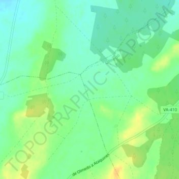
Name: Satarejo topographic map, elevation, terrain.
Location: Satarejo, Olmedo, Valladolid, Castille-et-León, Espagne (41.19877 -4.78204 41.21877 -4.76204)
Average elevation: 775 m
Minimum elevation: 763 m
Maximum elevation: 790 m