Geolocate

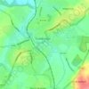
Lea topographic map

Click on the map to display elevation.

About this map
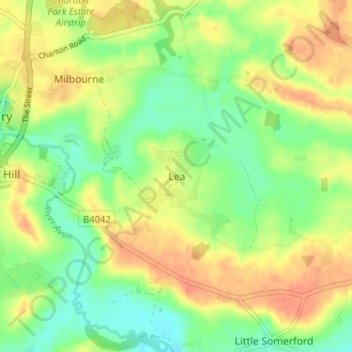
Name: Lea topographic map, elevation, terrain.

Location: Lea, Wiltshire, England, SN16 9FE, United Kingdom (51.55759 -2.08159 51.59759 -2.04159)

Average elevation: 82 m

Minimum elevation: 61 m

Maximum elevation: 102 m

Other topographic maps

Click on a map to view its topography, its elevation and its terrain.
Trowbridge

United Kingdom > England > Wiltshire

Average elevation: 47 m

Corsham

United Kingdom > England > Wiltshire

Average elevation: 98 m

Silbury Hill

United Kingdom > England > Wiltshire > Beckhampton

Average elevation: 166 m

Berwick St. John

United Kingdom > England > Wiltshire

Average elevation: 168 m

Southwick

United Kingdom > England > Wiltshire

Average elevation: 57 m

Gear up for your next adventure:

🌬️Windproof Camp Stove - Efficient cooking even on exposed mountain peaks
🧳Compression Sacks - Maximize space in your backpack by shrinking gear
🧥Waterproof Hiking Jacket - Protect yourself from rain and wind while hiking
🥽Outdoor Goggles - Protective eyewear for outdoor activities
⛺Camping Essentials - All-in-one gear for a comfortable camping trip

As an Amazon Associate, this site earns from qualifying purchases at no extra cost to you.