Geolocate

Weeki Wachee topographic map

Click on the map to display elevation.

About this map

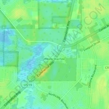
Name: Weeki Wachee topographic map, elevation, terrain.

Location: Weeki Wachee, Hernando County, Florida, United States (28.51018 -82.59216 28.52323 -82.56718)

Average elevation: 11 m

Minimum elevation: 2 m

Maximum elevation: 22 m

Other topographic maps

Click on a map to view its topography, its elevation and its terrain.

Norman

United States > Florida > Hernando County

Average elevation: 27 m

Hill 'n Dale

United States > Florida > Hernando County

Average elevation: 30 m

Gear up for your next adventure:

🥾Lightweight Hiking Shoes - Comfortable shoes for day hikes
🧴Sunscreen SPF - Broad-spectrum sunscreen for outdoor activities
🧢Outdoor Visor - Breathable visor for sunny hikes
🔦UV Flashlight - Detect minerals or specific insects in the dark
💡Portable Camping Lamp - Rechargeable lamp for campsite lighting

As an Amazon Associate, this site earns from qualifying purchases at no extra cost to you.