Geolocate

Norman topographic map

Click on the map to display elevation.

About this map

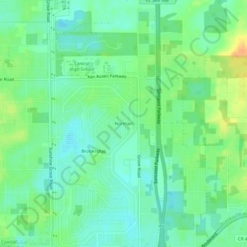
Name: Norman topographic map, elevation, terrain.

Location: Norman, Hernando County, Florida, United States (28.53555 -82.50649 28.57555 -82.46649)

Average elevation: 27 m

Minimum elevation: 14 m

Maximum elevation: 48 m

Other topographic maps

Click on a map to view its topography, its elevation and its terrain.

Weeki Wachee

United States > Florida > Hernando County

Average elevation: 11 m

Gear up for your next adventure:

🧢Hiking Hat - Sun-protective and breathable hats for long treks
🚲MTB Frame Bag - Carry tools and maps directly on your bicycle frame
Camping Groundsheet - Protect your tent from moisture and dirt
🦟Insect Repellent - Keep mosquitoes and black flies away in wooded areas
🛶Canoe Life Vest - Safety vest for water sports

As an Amazon Associate, this site earns from qualifying purchases at no extra cost to you.