Geolocate

Kamm topographic map

Click on the map to display elevation.

About this map

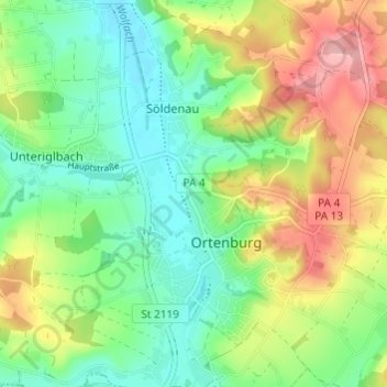
Name: Kamm topographic map, elevation, terrain.

Location: Kamm, Söldenau, Ortenburg, Landkreis Passau, Bayern, 94496, Deutschland (48.53177 13.20103 48.57177 13.24103)

Average elevation: 383 m

Minimum elevation: 334 m

Maximum elevation: 464 m

Other topographic maps

Click on a map to view its topography, its elevation and its terrain.

Gear up for your next adventure:

🥾Mountaineering Boots - Supportive boots for climbing and high-altitude hiking
🛌Down Sleeping Bag - Superior warmth-to-weight ratio for cold nights
💧Collapsible Water Bottle - Space-saving water bottle for outdoor activities
🕶️Polarized Sunglasses - Protect your eyes with durable polarized lenses
🥾Waterproof Hiking Boots - Boots keeping your feet dry in wet conditions

As an Amazon Associate, this site earns from qualifying purchases at no extra cost to you.