Geolocate

Bacsil topographic map

Click on the map to display elevation.

About this map

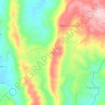
Name: Bacsil topographic map, elevation, terrain.

Location: Bacsil, La Union, Ilocos Region, Philippines (16.59714 120.35601 16.63714 120.39601)

Average elevation: 163 m

Minimum elevation: 28 m

Maximum elevation: 335 m

Gear up for your next adventure:

🥽Outdoor Goggles - Protective eyewear for outdoor activities
🧰Multitool Knife - Compact and versatile tool for outdoor use
🥾Trekking Boots - Durable boots for long-distance trekking
🩹Compact First Aid Kit - Pre-packed essentials for common trail injuries
🪑Insulated Seat Pad - Protect your seat from cold rocks and wet logs

As an Amazon Associate, this site earns from qualifying purchases at no extra cost to you.