Geolocate

Kodigehalli topographic map

Click on the map to display elevation.

About this map

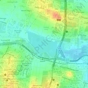
Name: Kodigehalli topographic map, elevation, terrain.

Location: Kodigehalli, Yelahanka Zone, Bengaluru, Bangalore North, Bengaluru Urban District, Karnataka, India, Hebbal Lake (13.04335 77.58100 13.05103 77.59173)

Average elevation: 904 m

Minimum elevation: 886 m

Maximum elevation: 929 m

Other topographic maps

Click on a map to view its topography, its elevation and its terrain.

Nagawara Lake

India > Karnataka > Bangalore North > Bengaluru

Average elevation: 896 m

Nagarbhavi Lake

India > Karnataka > Bangalore North > Bengaluru

Average elevation: 853 m

Cubbon Park

India > Karnataka > Bangalore North > Bengaluru

Average elevation: 917 m

HRBR Layout

India > Karnataka > Bangalore North > Bengaluru

Average elevation: 895 m

Banni Mantapa

India > Karnataka > Bangalore North > Bengaluru

Average elevation: 882 m

Bugle Rock Park

India > Karnataka > Bangalore North > Bengaluru

Average elevation: 908 m

Bangalore Palace

India > Karnataka > Bangalore North > Bengaluru

Average elevation: 927 m

Madhavan Park

India > Karnataka > Bangalore North > Bengaluru

Average elevation: 916 m

Nagawara Lake

India > Karnataka > Bangalore North > Bengaluru

Average elevation: 896 m

Gear up for your next adventure:

🧼Biodegradable Camp Soap - Environmentally friendly cleaning for gear and body
Camping Groundsheet - Protect your tent from moisture and dirt
🎒Backpack Rain Cover - External shield to keep your entire pack dry
🎒Fully Waterproof Backpack - Total protection for photography gear and electronics
🦶Hiking Shoe Insoles - Added support for high arches and long days on feet

As an Amazon Associate, this site earns from qualifying purchases at no extra cost to you.