Geolocate

Calpine topographic map

Click on the map to display elevation.

About this map

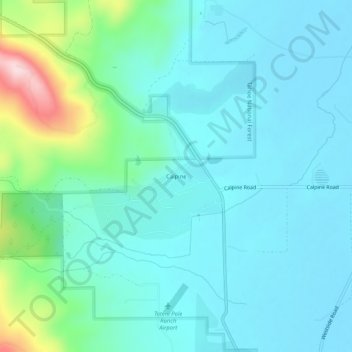
Name: Calpine topographic map, elevation, terrain.

Location: Calpine, Sierra County, California, 96124, United States (39.64629 -120.45966 39.68629 -120.41966)

Average elevation: 1,551 m

Minimum elevation: 1,496 m

Maximum elevation: 1,798 m

Gear up for your next adventure:

🔭Outdoor Binoculars - Lightweight binoculars for birdwatching and hiking
🧥Insulated Jacket - Keep warm in cold outdoor conditions
🧥Thermal Layer - Insulating layer for cold outdoor conditions
🧦Thermal Socks - Warm socks for winter hiking or camping
🥾Mountaineering Boots - Supportive boots for climbing and high-altitude hiking

As an Amazon Associate, this site earns from qualifying purchases at no extra cost to you.