Geolocate

Tiogollo topographic map

Click on the map to display elevation.

About this map

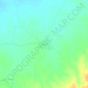
Name: Tiogollo topographic map, elevation, terrain.

Location: Tiogollo, Magdalena, Colombia (10.32158 -74.75449 10.36158 -74.71449)

Average elevation: 28 m

Minimum elevation: 17 m

Maximum elevation: 51 m

Gear up for your next adventure:

🧭Orienteering Kit - Tools for map reading and navigation in the wild
🥾All-Terrain Hiking Boots - Versatile boots for varied hiking conditions
🦌Outdoor Trail Camera - Monitor wildlife activity near your favorite spots
💡LED Camping Lantern - Illuminate your campsite with long-lasting lanterns
🧰Survival Kit - Essential gear for emergencies in the wilderness

As an Amazon Associate, this site earns from qualifying purchases at no extra cost to you.