
Erata topographic map
Interactive map
Click on the map to display elevation.
About this map
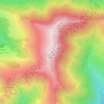
Name: Erata topographic map, elevation, terrain.
Location: Erata, Biescas, Alto Gállego, Huesca, Aragón, España (42.59317 -0.23102 42.59327 -0.23092)
Average elevation: 1,700 m
Minimum elevation: 1,278 m
Maximum elevation: 2,001 m
Other topographic maps
Click on a map to view its topography, its elevation and its terrain.